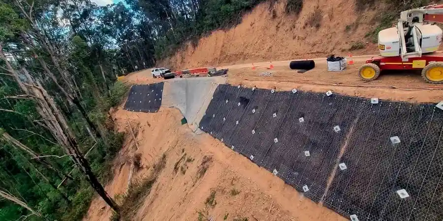
Greensboro sits at an elevation where the Piedmont meets the coastal plain, and that geology tells a story. The city’s rolling terrain, carved by countless creeks draining toward the Haw River watershed, creates distinct challenges for anyone moving earth. With over 300,000 residents and a construction sector that hasn’t slowed since the Toyota battery plant announcement, demand for reliable geotechnical data has never been sharper. A slope stability analysis isn’t just a box to check—it’s the difference between a retaining wall that holds for decades and one that shifts after a heavy rain. We’ve seen too many Greensboro sites where the residual micaceous soils, weathered directly from the bedrock, behave unpredictably once the root mat is stripped away. When you’re grading for a subdivision off Battleground Avenue or cutting into a hillside near Lake Brandt, understanding the factor of safety of that slope is non-negotiable. We combine decades of regional experience with a methodical approach, often pairing the analysis with a test pit investigation to visually confirm the rock weathering profile before running the stability models.
A slope that stands for 50 years can fail in one rainy season once the vegetation is removed—our analysis quantifies that risk before the excavator arrives.
Our approach and scope
Local context
Under the International Building Code as adopted by Greensboro, any cut or fill exceeding 5 feet requires a geotechnical evaluation, but that’s just the legal minimum. The real exposure in this area comes from the saprolite contact. When you excavate into a hillside and expose the transition zone between soil and weathered rock, water migrates along that interface and can reduce the factor of safety from 1.8 to 0.9 in a matter of hours during a summer thunderstorm. We’ve investigated failures on sites off Wendover Avenue where the trigger wasn’t the slope angle—it was a leaking storm drain that saturated the fill behind a wall. A rigorous slope stability analysis maps these vulnerabilities before construction, so the drainage design, slope reinforcement, or setback requirements are baked into the civil drawings from day one. Ignoring the analysis means accepting liability for a failure that could destabilize adjacent properties, block access roads, or delay the project finish by months.
Regulatory framework
ASCE 7-22 Minimum Design Loads and Associated Criteria for Buildings and Other Structures, IBC 2021 (International Building Code) Chapter 18 Soils and Foundations, ASTM D1586 Standard Test Method for Standard Penetration Test (SPT) and Split-Barrel Sampling, ASTM D2487 Standard Practice for Classification of Soils for Engineering Purposes (Unified Soil Classification System), USDA-NRCS Soil Survey of Guilford County for regional mapping context
Related services
Stability Modeling
Two-dimensional limit equilibrium analysis for natural slopes, cut slopes, and embankment fills using Spencer and Morgenstern-Price methods to satisfy both force and moment equilibrium.
Site Characterization
Drilling, sampling, and in-situ testing to define the soil and rock profile across the slope, with particular focus on the residual soil/saprolite/bedrock contacts common in the Piedmont.
Drainage and Remediation Design
Design of horizontal drains, interceptor trenches, and surface water management systems to lower the groundwater table and increase the factor of safety without excessive earthwork.
Construction Monitoring
Instrumentation plans using inclinometers and piezometers to track slope movement and pore pressure during mass grading operations, providing early warning of instability.
Typical parameters
FAQ
How much does a slope stability analysis cost for a typical Greensboro residential lot?
For a single-family lot requiring a cut or fill analysis, the engineering study typically ranges from US$1,390 to US$4,190, depending on whether drilling is needed and how complex the groundwater conditions turn out to be. A commercial subdivision with multiple cross-sections will fall on the higher end due to the extra modeling and reporting time.
Does Greensboro’s geotechnical review process require a slope stability report?
Yes. The City of Greensboro’s Technical Review Committee follows IBC Chapter 18, and any slope steeper than 3H:1V typically triggers a review. The report must include the factor of safety, the analysis method, the soil parameters used, and the groundwater assumptions, all stamped by a licensed professional engineer.
What’s the biggest mistake you see on Greensboro slope projects?
Assuming the soil strength is constant with depth. In our Piedmont geology, the upper colluvium can be weaker than the underlying saprolite, and we often find a thin layer of slickensided clay at the soil-rock interface. If the analysis uses a single average strength value, it misses the weak plane where the failure actually occurs. We always run sensitivity checks at that interface.